
17100 Sandy Ford Road
Chesterfield, Virginia 23838
$885,000
Room for your next chapter.
Explore the possibilities for a private estate, homestead, or rural retreat on 60.06 acres in Chesterfield County.
By appointment · 48-hour notice requested. Please arrange access with the listing team.
A place to shape around your vision.
This expansive Sandy Ford Road property offers wooded acreage and space to explore a future homestead, private estate, or rural retreat. Consider gardens, outdoor recreation, or a custom-home vision, subject to verification of permitted uses and site suitability.
An existing residence provides a potential renovation project, and several accessory buildings may offer restoration opportunities. The home is a basic shell in need of remodeling and is offered as-is. Buyers should independently evaluate the condition and suitability of all improvements.
The property also offers an opportunity to investigate a rural, large-lot residential subdivision. No lot yield or development approval is represented. Any development concept depends on independent studies, access, utilities, soils, environmental limits, and applicable approvals.
Residence area and room count are reported in the supplied listing and county records; they do not describe a move-in-ready home. Buyer to verify condition, acreage, boundaries, utilities, and all intended uses.
Listing courtesy of HighGate Homes · Jon Beckner and Lisa Hyatt.
List price confirmed by seller’s listing broker October 14, 2026. Property facts from the supplied MLS sheet dated October 9, 2026 and county assessment record dated September 24, 2026. Price and availability are subject to change. Information deemed reliable but not guaranteed.
The property and its surroundings.
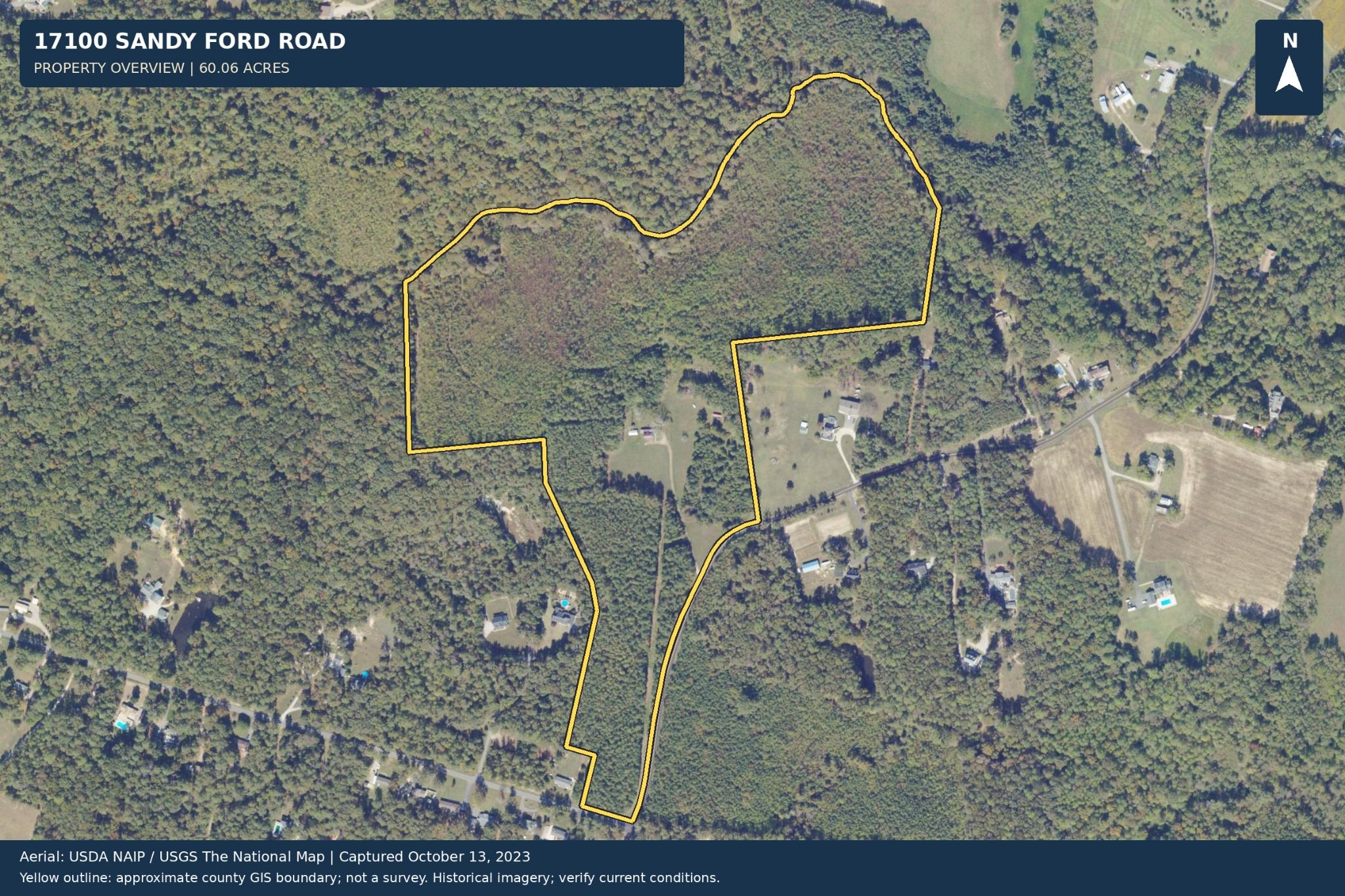
Property overview
A view of the acreage and its approximate relationship to Sandy Ford Road. The yellow boundary is illustrative, not a survey.
Download property aerial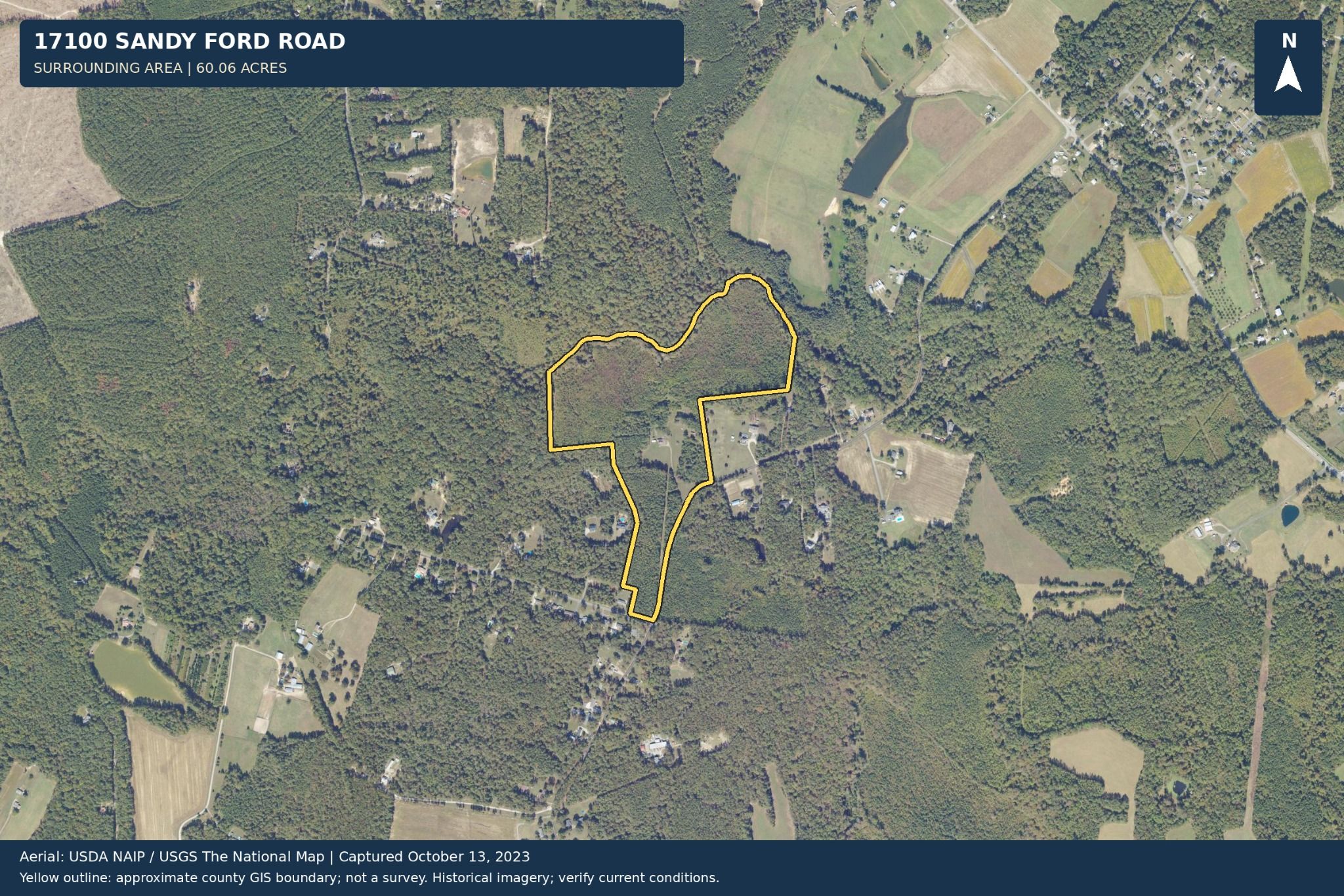
Surrounding area
Historical aerial context for the property and neighboring land. Verify current conditions and boundaries independently.
Download area aerialAerial source: USDA NAIP / USGS The National Map. Imagery dated October 13, 2023. Supplied map annotations are retained.
Information to guide your next questions.
Review preliminary mapping as a starting point for independent due diligence. These exhibits have not been verified by engineers and do not establish buildable acreage, septic approval, or development entitlement.
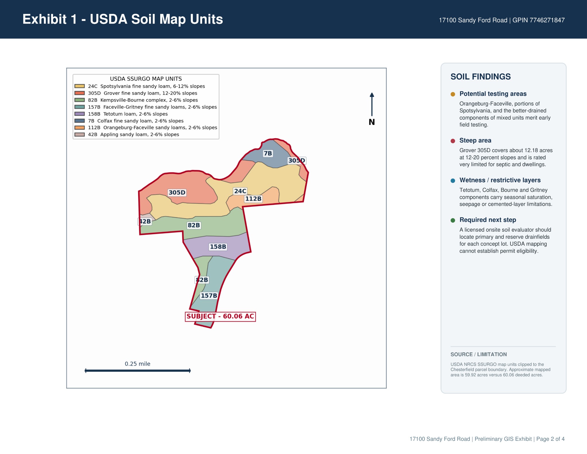
USDA soils exhibit
Mapped soil units and preliminary considerations. Site-specific soil evaluation and permitting are needed to establish septic suitability.
Download soils exhibit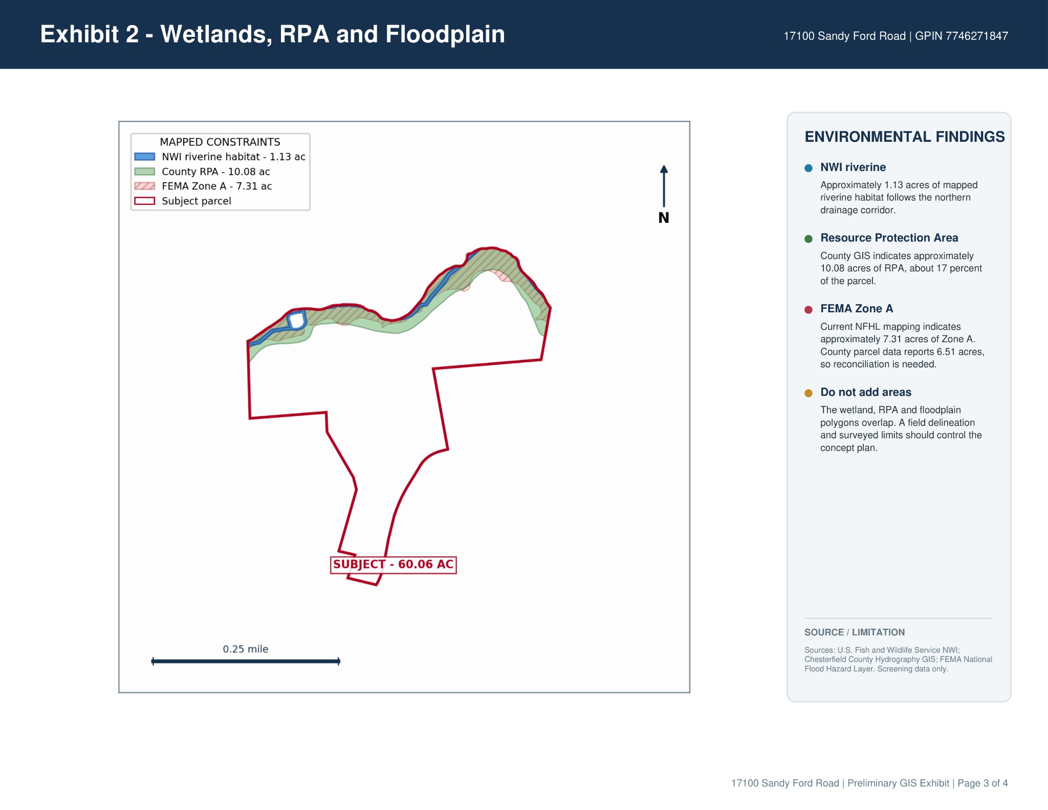
Environmental exhibit
Mapped wetlands, Resource Protection Area, and floodplain screening. These areas overlap and must not be added together. Field delineation and surveyed limits are needed.
Download environmental exhibitUtilities and development considerations
The existing property is reported as served by well and septic. Public-water connections are reported on adjoining parcels, but service availability and capacity for this property are not confirmed. The supplied county record lists county water and sewer as unavailable; buyers should verify current conditions directly with the utility provider.
County parcel records and the preliminary exhibit report different floodplain acreage figures. That difference requires reconciliation. No field wetland delineation, surveyed environmental limits, approved subdivision plan, or lot-specific septic permits have been supplied or verified.
See the possibilities at Sandy Ford Road.
Contact Jon to arrange a showing, request property information, or discuss the questions to investigate for your intended use.
Showings by appointment with the listing team.